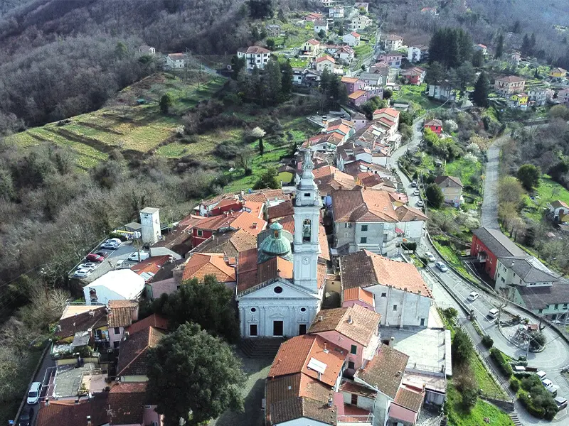

The hamlet of Carro is located in the province of La Spezia and more precisely in the Alta Val di Vara, an area in the Ligurian Apennines behind the Cinque Terre National Park. The hamlet, included in the Montemarcello-Magra Regional Nature Park, is located at an altitude of 418 metres a.s.l. along a hill between the valleys of the Rio di Agnola and Rio Travo, watercourses that join to form the Trambacco, a tributary of the Vara river.
The municipality, including the hamlets of Agnola, Castello, Cerreta, Pavareto, Pera, Ponte Santa Margherita and Ziona, covers an area of approximately 34 square kilometres.

 Views
Views
Visiting Carro and its hamlets is an activity to be experienced calmly, savouring, in the quietness of the area, colours, details and nuances that perfectly represent the life of the many gems set in the Val di Vara.

CLICK AND BROWSE

CLICK AND BROWSE
 The villages and hamlets
The three hamlets Castello, Ponte Santa Margherita and Ziona surround Carro to the north, east and south-east respectively. From Castello (538 a.s.l.) and Ziona (350 a.s.l.) it is possible to enjoy beautiful views of Carro while Ponte Santa Margherita (178 a.s.l.) is located along the Vara river, next to the Santa Margherita Vara dam, and represents the entry point into the municipal territory coming from Sesta Godano and Carrodano.
In addition to the 3 hamlets, the Municipality of Carro includes several historic villages, suggestive places and stops not to be missed when visiting the area: Agnola, Pera, Cerreta and Pavareto.
 History
Carro, in the root of the word itself, – carra, stone – reveals very ancient origins that linguists call ‘pre-Indo-European’, predating the movement of Indo-European-speaking peoples from Central Asia westwards between the 4th and 2nd millennia. Findings on Monte Castelfermo and in the valley below in the locality of Cota attest to the presence of the Ligurian Iron Age man (5th-4th century B.C.). Its territory was probably home to some settlements when the Romans conquered Liguria in 155 BC. Documents tell how Carro, in medieval times, had an important development due to its strategic position on the busy communication route from the sea to the Po Valley region.
This hamlet was an ancient religious colony of the vicariate of Framura until the feudal property passed first to the Estensi, in the 11th century, and later to the Malaspina; the latter ceded the feudal property to the Da Passano family at the behest of the diocese of Brugnato. A free commune in 1229, it entered into an alliance with the ‘Compagna Januae’, placing itself under the protection of Genoa. Involved in the struggles between the Guelfi and Ghibellini, Carro was occupied by the Fieschi family in 1271-1272, but finally submitted to the Genoese republic, which erected it as an office of a podestà in 1299. From 1556 it had its own statutes.
Under the French rule of Napoleon Bonaparte, in 1779, the territory of Carro was included in the Vara Department of the Ligurian Republic with Levanto as its capital. Annexed to the First French Empire from 1805 to 1814, it became part of the Department of the Apennines.
In 1815, it was incorporated into the province of Levante of the Kingdom of Sardinia and from 1861 became part of the Kingdom of Italy as a municipality belonging to the province of Genoa before passing under the province of La Spezia when it was established in 1923.


